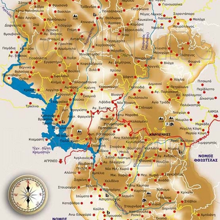
Geography of Viniani

Photo credit: NTUA Research Team
The village of Viniani was founded in the municipality of Agrafa, a mountainous area named after the Greek word "Agrafa" (Unwritten) as a nod towards the region's harsh terrain--a trait which prevented the invading Ottoman Empire from ever fully controlling the territory.
While most villages in Agrafa are settled along the Agrafiotis River, Viniani sits atop a steep hillside close to the Tavropos River (also known as the Megdova River).
Viniani can be seen in the center of both the maps provided below.

Photo credit: Pitichinaccio, Public domain, via Wikimedia Commons

Viniani is centered in the middle of this interactive map.
You can click, drag, and zoom in with your mouse wheel to explore the area in detail.
The Tavropos (Megdova) River

Photo credit: Nature Drone Makis Theodorou on Youtube
Winding its way through the peaks of Evrytania, the Tavropos River (sometimes called the Megdova) lies to the east of Viniani. Though its depth fluctuates with the seasons, it's typically deep enough for activities such as swimming and rafting.
Dating back to the early 1700's, the stone bridge that crosses the Tavropos (Megdova) River has historically been a crucial landmark connecting the village of Viniani to Greece's greater history. It served as one of the few safe routes across the river in Agrafa during the Ottoman occupation of Greece, and later was utilized by immigrants at the outset of their journey from the village.


